TESTIMONY ON GAITHERSBURG WEST MASTER PLAN
March 26, 2009
The proposed Gaithersburg West master plan is not transit-oriented development. We have several fundamental objections to the plan:-
No direct access to rail transit is provided. A shuttle bus that uses highway shoulders on the way to Shady Grove seems to be all that is required before 100% of the plan's residential development and 80% of its non-residential development can go forward.
-
The transportation analysis uses circular reasoning. It assumes that automobile use will resemble truly transit-oriented development and bases its predictions of traffic on that assumption.
-
The street network is automobile- rather than transit-oriented. Pedestrian movement will be blocked by high-speed arterial highways.
-
The location of the policy area is at the periphery of the transit system and therefore employment in the area will not be attractive to transit riders. Intense job development in this area would have the same selling point as Tysons Corner – it is convenient to the CEO decision-maker (near Potomac in one case, McLean or Great Falls in the other) who will enjoy an easy commute while his or her employees suffer through traffic jams.
We are firmly convinced that a large, dense, transit-oriented white-collar employment node can be created in Montgomery County only within walking distance of a rail station. There is no successful example to the contrary anywhere in the United States. Moreover, Gaithersburg West is located at the periphery of the transit network, and the analyses in the master plan provide no reason to believe that jobs located there will have high transit usage even if rail access is provided.
We recommend that the Planning Board reject the draft plan and draw up a new plan with land use and density appropriate to an area that is not transit-oriented.
Lack of transit
As the proposed master plan is currently written, the Corridor Cities Transitway could morph into nothing more than a shuttle bus that uses the shoulder of Sam Eig Highway during rush hour.
The staging requirement for Phase 2, which includes 80% of non-residential development, is that the county or state “Fund the CCT from the Shady Grove Metro Station to the Belward property.” (See pp. 62-63.) The plan anticipates that the CCT will be a bus rapid transit route. Bus rapid transit is a poorly defined term that can mean many things, anything from a bus that runs on ordinary roads and skips stops or gets a slight advantage at traffic lights to something on its own right of way with grade-separated crossings at intersections.
The ICC and its continuation, Sam Eig Highway, run directly from Shady Grove to Belward Farm. On page 36, the shoulder of Sam Eig Highway is designated as a BRT route, to be used by buses only in the direction of peak flow (whatever that is). Traffic on the Intercounty Connector will be managed to limit congestion, so a bus running on the approach to the ICC between I-270 and Shady Grove would also satisfy many definitions of BRT. Thus, it would be easy to argue that the staging requirement would be satisfied by a shuttle bus that is allowed to use the shoulder of Sam Eig Highway during rush hour, similar to the Metrobus routes that use the shoulder of U.S. 29.
A further difficulty ignored by the master plan is that Montgomery County policies currently preclude the operation of at-grade BRT even if a transitway is built. The county's traffic engineering policy forbids any priority for buses over other vehicles. See ACT's letter to the County Executive of Dec. 8, 2008, which still awaits a substantive response. The master plan staging requirements only refer to construction of a BRT facility; they do not require that the buses actually operate as BRT.
To have real meaning, the staging requirement would need to be strengthened to require rail. At a minimum, the performance characteristics of the BRT line would need to be specified, such as station locations, dedicated right of way, and grade-separated intersections. Reversal of the county policy forbidding bus priorities would also be necessary as a Phase 1 staging requirement.
Transportation analysis based on circular reasoning
The premise of the proposed master plan is that new development will be transit-oriented and rely on non-automobile transportation. Its advocates base their support for it on this proposition. But its transportation studies provide no support for this assertion.
There are two separate analyses, an overall analysis for the Policy Area Mobility Review which used the MWCOG model and an intersection analysis for the Local Area Transportation Review. Neither analysis asks the fundamental question of how many people will drive to work in Gaithersburg West; instead, they simply assume that people will behave as planners desire.
The LATR intersection congestion analysis assumes that automobile trip generation rates (the number of autos that leave a building per unit of building size) will be the same as in the transit-oriented development like around White Flint. (See transportation appendix, pp. 49-50.) No evidence is presented for this assumption, and there are numerous reasons to think that a building in Gaithersburg West will generate more auto trips than the same building at White Flint:
-
White Flint is within walking distance of Metrorail; Gaithersburg West will be connected to Metrorail by a shuttle bus (either running on its own right of way with numerous stops, or on the Sam Eig Highway shoulder).
-
White Flint is closer to the core of the Metropolitan area and therefore travel times are shorter for the great majority of transit riders.
-
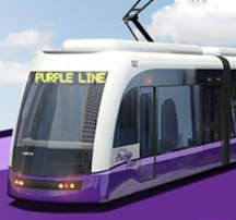
White Flint will have good transit access via the Red and Purple Lines to biomedical institutions such as NIH, Bethesda Naval Hospital, Walter Reed Annex the FDA in College Park, and the University of Maryland. Gaithersburg West is far from these destinations – more than an hour from College Park.
The overall modeling for PAMR also starts from an assumption about how many commuters get to work without driving. As stated on p. 38 of the appendix, the assumption was that this percentage is 32.5%. (Planners subsequently reduced this to 30%.)
Unlike the models used for LATR, the COG model has the capability of predicting transit usage. Reflecting the actual conditions planned for Gaithersburg West, the model predicts a low transit mode share. For the scenario in which there is no residential development, the transit mode share is 8%. (When residential development is included in the plan, the overall transit mode share increases somewhat because many residents work in transit-oriented areas and have a greater propensity to use transit than people who work in the transit-inaccessible workplaces of Gaithersburg West.)
To produce model output, the master plan's plainly counterfactual assumptions about automobile use somehow had to be reconciled with the reality of low transit ridership. As best we can tell, this is the reason that the PAMR model results grossly exaggerate how many commuters will carpool.1 In the high scenario, 24% of all employees arrive by carpool. This is absurd. Carpooling by Gaithersburg residents is currently at a 5% level, and the use of carpools has been on the decline for several decades.
Transit access to Gaithersburg West will resemble today's Rock Spring Park (accessible by frequent shuttle bus service running on roads with little congestion) far more than it resembles White Flint. It seems very likely that the transit mode share for Gaithersburg West will be even lower than Rock Spring Park due to the latter's greater proximity to transit trip origins. Transportation models for Gaithersburg West should assume trip generation rates similar to, or greater than, what is currently seen in Rock Spring Park. This would surely lead to the conclusion that the non-auto mode share will be no greater than Rock Spring Park today – perhaps a few percent above the 8% transit mode share for employees that the model predicts – rather than the entirely unreasonable 30% postulated in the master plan.
Anti-urban street network
Transit-oriented development requires a grid of streets that may or may not vary in width, but all encourage pedestrian activity. Although the master plan street network avoids the worst excesses of suburban sprawl office park design, it fails to create a pedestrian-scaled grid street network to optimize transit access. Instead, there is a fundamentally automobile-oriented design which funnels vehicles into high-speed traffic sewers that become obstacles to movement of people.
Not only are the streets inappropriately designed, but there are simply not enough streets to provide adequate connectivity. The planned street network has oversized, hard-to-get-around blocks like Rock Spring Park, not urban walkable blocks like downtown Bethesda and Silver Spring. Connectivity can be measured by the number of intersections per square mile. In the Belward, West, and Central subareas (the only subareas where the street network is being fully redesigned), approximately 39 interior intersections and 25 on the boundary are proposed. These subareas have an aggregate area of 400 acres, giving approximately 66 intersections per square mile. Under LEED-ND standards now under development, a minimum of 150 intersections per square mile is required, and at least 400 intersections per square mile are needed to win the highest score.
To create a street network oriented primarily toward transit rather than toward automobile use, changes along the following lines would be required:
-
Convert Sam Eig Highway, Great Seneca Highway, Shady Grove Road, Darnestown Road, and Key West Avenue into boulevards with storefronts, active street life, and numerous signalized intersections, similar to what is proposed for Rockville Pike in the White Flint sector plan.
-
Reduce all speed limits to no greater than 30 mph.
-
Replace the seven proposed urban-diamond interchanges with Dupont Circle-like underpasses.
-
Increase the number of streets to create smaller blocks, with at least 300 intersections per square mile.
1The carpooling forecast is grossly inaccurate, whether or not we have correctly identified the cause of the error. Something important is clearly wrong with the model even if we are wrong about what the mistake is.